Yinyi Lin

GeoAI and remote sensing for healthier, more resilient, and sustainable cities.
Postdoctoral Fellow, Department of Geography, The University of Hong Kong
I am a geospatial scientist studying how urbanization and climate extremes shape environmental exposure, human health, and community resilience. My research integrates multisource satellite observations, environmental big data, spatial statistics, and artificial intelligence to produce high-resolution, policy-relevant evidence across cities and regions worldwide. I completed my PhD in Earth System and GeoInformation Science at The Chinese University of Hong Kong in 2021 and am now a Postdoctoral Fellow in Geography at The University of Hong Kong, where I work at the intersection of GeoAI, urban environmental health, climate risk, and sustainable urbanization.
Current research focus
GeoAI and multisource remote sensing
Urban environmental health
Climate risk and community resilience
Featured research
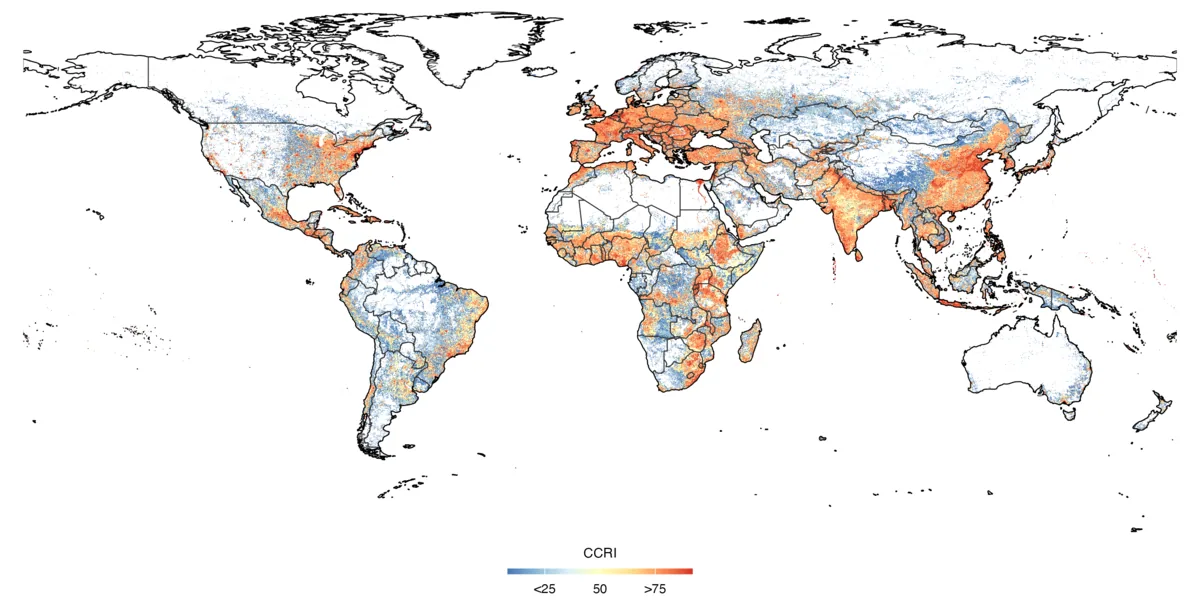
Community resilience to compound climate extremes
Where can communities cope with floods, droughts, and extreme temperatures at once — and does resilience to one hazard come at the expense of another? This work builds a high-resolution global Community-Climate Resilience Index from satellite data and geocoded disaster records, revealing regional and urban–rural inequality and trade-offs between hazards, especially in suburban and rural Sub-Saharan Africa.
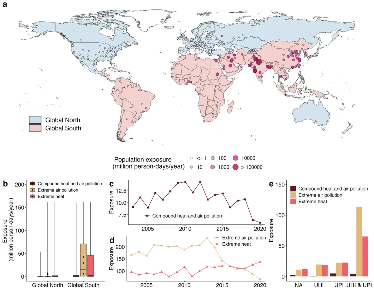
Compound urban heat, air pollution, and mortality
How much mortality risk do cities miss when urban heat islands and air-pollution islands are assessed separately rather than together? This work quantifies compound heat–pollution islands across Global North cities and shows that their combined mortality burden is underestimated.
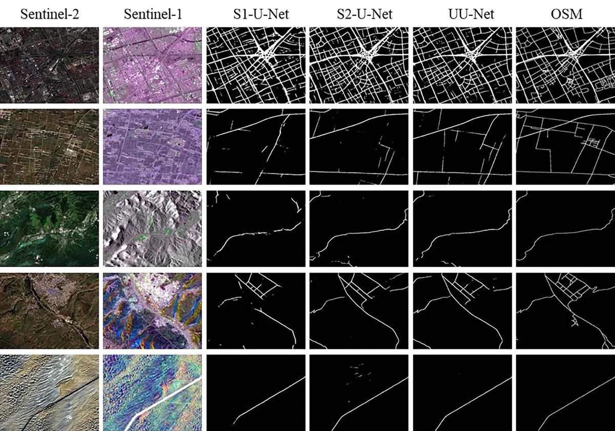
Multisource urbanization monitoring
How can optical and radar observations be combined to map urban land cover and expansion reliably — through clouds, shadows, and seasons — over decades? This line of work established fusion methods for impervious-surface mapping, road extraction, and intra-year urban renewal detection.
Selected publications
Four representative studies; the full record is on the publications page and Google Scholar.
Latest news
| Sep 29, 2026 | New paper in Earth’s Future: Global inequality and potential trade-offs in community resilience to compound climate extremes. |
|---|---|
| Jun 30, 2026 | Joined the Youth Committee of the Chinese National Committee of the International Society for Digital Earth (CNISDE). |
| Jun 02, 2026 | New paper in npj Urban Sustainability: Underestimated mortality risks from compound urban heat and air pollution islands in Global North cities. |
| Feb 02, 2026 | Co-authored perspective in Nature Communications: Promoting sustainable development worldwide in the metacoupled Anthropocene. |
| Oct 20, 2024 | Co-authored study in Communications Earth & Environment: Coastal urbanization may indirectly positively impact growth of mangrove forests. |